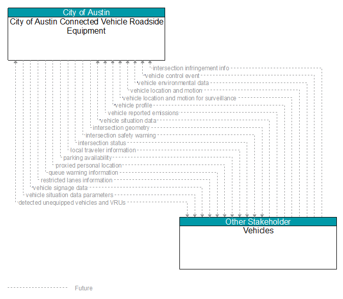
Interface: City of Austin Connected Vehicle Roadside Equipment - Vehicles
Information Flow Definitions
detected unequipped vehicles and VRUs (Future)
Notification of a nearby vehicle (light vehicle, commercial vehicle, MMV etc.) or vulnerable road user that does not appear to be equipped with a short range communications device but is detectable using onboard vehicle or infrastructure sensors. The flow communicates detected vehicle/VRU location, physical characteristics, observable kinematics and confidence in those measures.
intersection geometry (Future)
The physical geometry of an intersection covering the location and width of each approaching lane, egress lane, and valid paths between approaches and egresses. This flow also defines the location of stop lines, cross walks, specific traffic law restrictions for the intersection (e.g., turning movement restrictions), and other elements that support calculation of a safe and legal vehicle path through the intersection.
intersection infringement info (Future)
Vehicle path information sent by a vehicle that is performing an unpermitted movement at an intersection such as a stop sign violation or running a red light. This also includes information about possible conflicts with other road users in the vehicle's path, including a range of uncontrolled intersection scenarios that could be covered by this flow. This flow does not include permanent ids; only temporary ones that allow monitoring of the vehicle as it moves across the intersection.
intersection safety warning (Future)
A warning of an imminent unsafe vehicle infringement at an intersection that may endanger other vehicles or pedestrians. This allows vehicles approaching the intersection to be warned in the event of an imminent red light or stop sign violation or potential infringement on an occupied crosswalk. All connected vehicles and personal devices near the intersection receive the warning.
intersection status (Future)
Current signal phase and timing information for all lanes at a signalized intersection. This flow identifies active lanes and lanes that are being stopped and specifies the length of time that the current state will persist for each lane. It also identifies signal priority and preemption status and pedestrian crossing status information where applicable.
local traveler information (Future)
Traveler information including traffic, road, and weather conditions for a particular locality. This flow includes the location–specific traveler information and time effectivity of the information.
parking availability (Future)
Information on available parking. This flow identifies available spaces with associated information about parking restrictions and location for each available space. Specifically includes information on parking for commercial vehicles, coaches/buses, and cars – and likely also motorcycles, electric vehicle plugins, etc.
proxied personal location (Future)
Relay of pedestrian, bicyclist, and other non–motorized user locations at an intersection. This relay or rebroadcast of personal locations supports coordination between motorized and non–motorized users that do not have interoperable communications capability.
queue warning information (Future)
Information regarding formed or impending queues (location of the end of queue, estimated duration of the queue, and other descriptions of the queue condition) and recommendations for upstream vehicles including speed reduction, lane change, or diversion recommendations.
restricted lanes information (Future)
This flow defines the location, duration, and operating parameters for lanes that are reserved for the exclusive use of certain types of vehicles (e.g., transit vehicles) or vehicles that meet other qualifications (e.g., number of occupants, low emissions criteria). It identifies the lane(s), the start and stop locations, start and end times, vehicle restrictions, speed limits and platooning parameters.
vehicle control event (Future)
Notification that the vehicle has performed an emergency maneuver or action that could impact the safety of surrounding vehicles. This includes hard braking and activation of traction/stability control systems or other actions that warrant immediate notification of surrounding vehicles. The information flow conveys the current vehicle location, path, and current control actions. This may also include the list of maneuvers includes lane changes/departures and overtaking/passing maneuvers.
vehicle environmental data (Future)
Data from vehicle safety and convenience systems that can be used to estimate environmental and infrastructure conditions, including measured air temperature, exterior light status, wiper status, sun sensor status, rain sensor status, traction control status, anti–lock brake status, vertical acceleration and other collected vehicle system status and sensor information. The collected data is reported along with the location, heading, and time that the data was collected. Both current data and snapshots of recent events (e.g., traction control or anti–lock brake system activations) may be reported.
vehicle location and motion (Future)
Data describing the vehicle's location in three dimensions, heading, speed, acceleration, braking status, and size.
vehicle location and motion for surveillance (Future)
Data describing the vehicle's location in three dimensions, heading, speed, acceleration, braking status, and size. This flow represents monitoring of basic safety data ('vehicle location and motion') broadcast by passing connected vehicles for use in vehicle detection and traffic monitoring applications.
vehicle profile (Future)
Information about a vehicle such as vehicle make and model, fuel type, engine type, size and weight, vehicle performance and level of control automation, average emissions, average fuel consumption, passenger occupancy, or other data that can be used to classify vehicle eligibility for access to specific lanes, road segments, or regions or participation in cooperative vehicle control applications.
vehicle reported emissions (Future)
Current and average vehicle emissions data as measured by vehicle diagnostics systems and reported by the vehicle.
vehicle signage data (Future)
In–vehicle signing data that augments regulatory, warning, and informational road signs and signals. The information provided would include static sign information (e.g., stop, curve warning, guide signs, service signs, and directional signs) and dynamic information (e.g., local traffic and road conditions, restrictions, vehicle requirements, work zones, detours, closures, advisories, and warnings).
vehicle situation data (Future)
This flow represents vehicle snapshots that may be provided by the vehicle to support traffic and environmental conditions monitoring. Snapshots are collected by the vehicle for specific events (e.g., when a sensor exceeds a threshold) or periodically and reported based on control parameters when communications is available. Traffic–related data includes snapshots of measured speed and heading and events including starts and stops, speed changes, and other vehicle control events. Environmental data may include measured air temperature, exterior light status, wiper status, sun sensor status, rain sensor status, traction control status, anti–lock brake status, and other collected vehicle system status and sensor information. The collected data is reported along with the location, heading, and time that the data was collected.
vehicle situation data parameters (Future)
A request for vehicle situation data that includes parameters used to control the data that is reported and the flow of data reported by the vehicle. This flow identifies the type of data/snapshots that are requested and reporting parameters such as snapshot frequency, filtering criteria (data thresholds for reporting), and reporting interval.