Interface: TxDOT Austin District Transportation Information Center - Vehicles
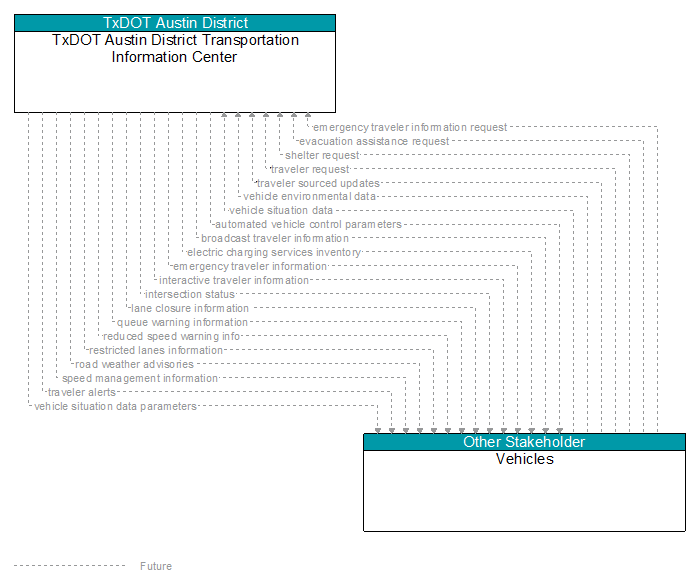
Information Flow Definitions
automated vehicle control parameters (Future)
Information, instructions, and control parameters for automated vehicle operations including current system conditions and advisories, control parameters (e.g., speed, required vehicle performance profiles, gaps or headways) and check in/checkout instructions.
broadcast traveler information (Future)
General traveler information that contains traffic and road conditions, link travel times, incidents, advisories, restrictions, vehicle requirements, work zones, transit service information, weather information, parking information, and other related traveler information.
electric charging services inventory (Future)
Information provided for electric charging stations identifying the location, operating hours, current availability, charging capacity and standards supported, access restrictions, and rates/fee structure.
emergency traveler information (Future)
Public notification of an emergency such as a natural or man–made disaster, civil emergency, or child abduction. This flow also includes evacuation information including evacuation instructions, evacuation zones, recommended evacuation times, tailored evacuation routes and destinations, traffic and road conditions along the evacuation routes, traveler services and shelter information, and reentry times and instructions.
emergency traveler information request (Future)
Request for alerts, evacuation information, and other emergency information provided to the traveling public.
evacuation assistance request (Future)
A request for evacuation assistance, which may be registered in advance or issued during an evacuation. It specifies the location, number of people that need to be evacuated, and any special needs/requirements.
interactive traveler information (Future)
Traveler information provided in response to a traveler request. The provided information includes traffic and road conditions, advisories, incidents, restrictions, payment information, transit services, parking information, weather information, and other travel–related data updates and confirmations.
intersection status (Future)
Current signal phase and timing information for all lanes at a signalized intersection. This flow identifies active lanes and lanes that are being stopped and specifies the length of time that the current state will persist for each lane. It also identifies signal priority and preemption status and pedestrian crossing status information where applicable.
lane closure information (Future)
Lane closure information provided to passing vehicles. This flow provides information about roadway configuration changes such as lane closures and shifts.
queue warning information (Future)
Information regarding formed or impending queues (location of the end of queue, estimated duration of the queue, and other descriptions of the queue condition) and recommendations for upstream vehicles including speed reduction, lane change, or diversion recommendations.
reduced speed warning info (Future)
Real time notification of vehicle detections, measured vehicle characteristics (e.g., vehicle height), speed measurements, and warnings issued by roadway infrastructure. This flow can also include roadway configuration data, current speed limits, and warning parameters and thresholds enabling local speed management application configuration and management.
restricted lanes information (Future)
This flow defines the location, duration, and operating parameters for lanes that are reserved for the exclusive use of certain types of vehicles (e.g., transit vehicles) or vehicles that meet other qualifications (e.g., number of occupants, low emissions criteria). It identifies the lane(s), the start and stop locations, start and end times, vehicle restrictions, speed limits and platooning parameters.
road weather advisories (Future)
Segment–specific weather and road conditions including real–time advisories of deteriorating road and weather conditions, medium–term advisories for the next 2–12 hours, and long–term advisories more than 12 hours into the future. The advisories may include advisories that are issued based on locally collected environmental data (e.g., an ice on bridge advisory).
shelter request (Future)
A request for shelter information, recommendations, or assignment/reservation. Information provided my include name, current location, number of people in the group, additional requirements (e.g., evacuating with pets, needed medical support).
speed management information (Future)
Target speeds, speed advisories, and/or speed limit information provided to a vehicle. The information includes the current speed value(s), the route segment(s) and lane(s) where the speeds apply, and an indication of whether the speeds are suggested target speeds, posted advisory speeds, or enforceable speed limit values. This flow may also include information about the reason for reduced speeds and provide target lane information if lane changes are required.
traveler alerts (Future)
Traveler information alerts reporting congestion, incidents, adverse road or weather conditions, restrictions, vehicle requirements, parking availability, transit service delays or interruptions, and other information that may impact the traveler. Relevant alerts are provided based on traveler–supplied profile information including trip characteristics and preferences.
traveler request (Future)
A request for traveler information including traffic, transit, toll, parking, road weather conditions, event, and passenger rail information. The request identifies the type of information, the area of interest, parameters that are used to prioritize or filter the returned information, and sorting preferences.
traveler sourced updates (Future)
Traveler posts on traffic and road conditions, parking availability, transit services, traveler services, shelter information, hazards, debris, obstacles, and other real–time crowd–sourced data that may be shared with other travelers.
vehicle environmental data (Future)
Data from vehicle safety and convenience systems that can be used to estimate environmental and infrastructure conditions, including measured air temperature, exterior light status, wiper status, sun sensor status, rain sensor status, traction control status, anti–lock brake status, vertical acceleration and other collected vehicle system status and sensor information. The collected data is reported along with the location, heading, and time that the data was collected. Both current data and snapshots of recent events (e.g., traction control or anti–lock brake system activations) may be reported.
vehicle situation data (Future)
This flow represents vehicle snapshots that may be provided by the vehicle to support traffic and environmental conditions monitoring. Snapshots are collected by the vehicle for specific events (e.g., when a sensor exceeds a threshold) or periodically and reported based on control parameters when communications is available. Traffic–related data includes snapshots of measured speed and heading and events including starts and stops, speed changes, and other vehicle control events. Environmental data may include measured air temperature, exterior light status, wiper status, sun sensor status, rain sensor status, traction control status, anti–lock brake status, and other collected vehicle system status and sensor information. The collected data is reported along with the location, heading, and time that the data was collected.
vehicle situation data parameters (Future)
A request for vehicle situation data that includes parameters used to control the data that is reported and the flow of data reported by the vehicle. This flow identifies the type of data/snapshots that are requested and reporting parameters such as snapshot frequency, filtering criteria (data thresholds for reporting), and reporting interval.